

Surveying and Mapping
Pro Data Collection & Analysis
-
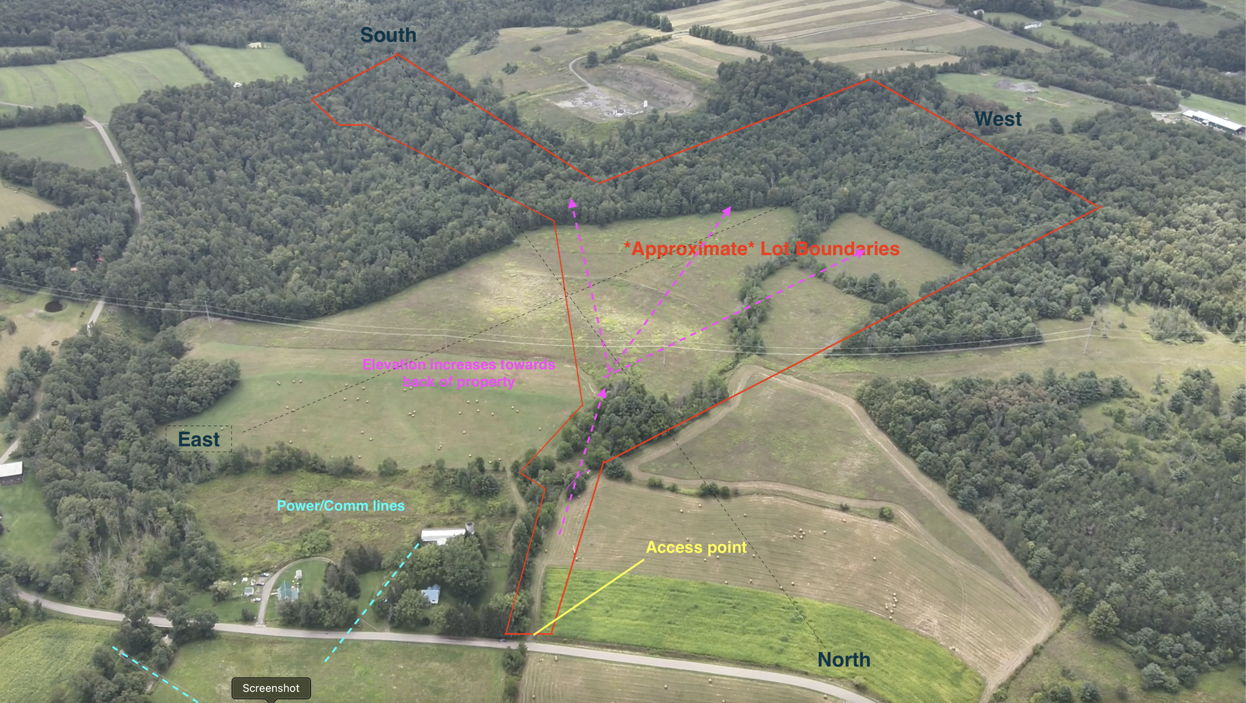
Complete Land Survey
We offer in-depth aerial surveys for your property. In addition to beautiful media for your use in marketing, we offer a detailed property report that includes our analysis of suitable building locations, hazards, utilities, etc. Download our free sample report and contact us for a quote!
-

Parking and Traffic Patterns
We are the region's experienced pros when it comes to aerial data capture. This includes parking and traffic surveys, including time-stamped/gapless footage when requested. Whether it's a franchise location, a parking lot or an intersection, we can get you the data you need.
-

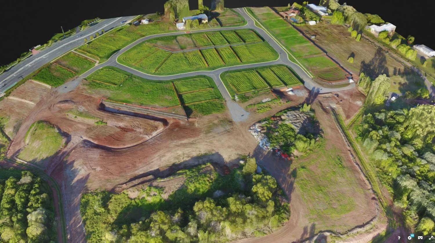
Ultra Precision
Using a leading technology to refine GPS signal accuracy, we offer orthomosaic stitched maps with sub-centimeter-level accuracy. Each image is geotagged, corrected and stitched into a a larger image. These images can be used in precision surveys., roofing & more.
-
3D Modeling
We offer a number of 3D options to our clients, including both image and video-based data capture, point cloud data and more.